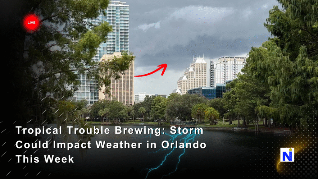
Tropical Trouble Brews: What Invest 93L Could Mean for Weather in Orlando
It’s that time of year again—when eyes turn nervously to the Gulf of Mexico, and residents up and down the Southeast U.S. start refreshing radar maps like it’s a new TikTok trend. This time, all the attention is on Invest 93L, a tropical disturbance in the Bay of Campeche that’s gaining steam fast and could significantly affect the weather in Orlando and beyond.
With forecasters warning of a potential tropical depression or storm within 48 hours, and the system inching toward the Gulf Coast, it’s not just coastal cities that need to brace. Central Florida, including Orlando, may be in for heavy rain, gusty winds, and widespread weather disruptions.
Let’s break down everything you need to know about Invest 93L, what the models are saying, and how to get ready—without panic, but with plenty of preparedness.
What Is Invest 93L and Why Is It Important?
Anatomy of a Tropical Threat
Invest 93L is a label used by meteorologists to track a weather system under investigation. Currently, it’s sitting in the warm, storm-friendly waters of the Bay of Campeche, about 400 miles south of the Texas-Louisiana coastline.
Key Stats as of the Latest Advisory:
- 📍 Location: 22.5°N, 94.0°W
- 💨 Movement: North-northwest at 5–10 mph
- 📉 Pressure: 1006 mb and falling
- 🌊 Sea Surface Temp: Above 30°C
- 🌪 Formation Chance (48 hrs): 80%
- 🌪 Formation Chance (7 days): 90%
Why Central Florida Should Pay Attention
Even though Invest 93L is forming far from Orlando, its projected path could have ripple effects across the entire Southeastern U.S., including significant weather in Orlando. If the system strengthens into Tropical Storm Lee, and landfall occurs later this week, tropical moisture could spread into the interior—bringing flooding rains, power outages, and traffic nightmares.
Forecast and Timing: What to Expect This Week
NHC & Spaghetti Model Guidance
The National Hurricane Center (NHC) gives this storm a high chance of development. Forecast models (the famous spaghetti plots) mostly point toward a landfall between Texas and the Florida Panhandle, with some models dragging post-tropical remnants across Florida by the weekend.
Possible Development Timeline:
| Day | Forecast Event |
|---|---|
| Tuesday | Tropical Depression Possible |
| Wednesday | Potential Tropical Storm Formation |
| Thurs/Fri | Landfall Between TX and FL Panhandle |
| Weekend | Rain, Winds Affecting Orlando Area |
Key Florida Cities on Alert:
- Orlando 🌧️
- Tampa 🌧️
- Tallahassee 🌬️
- Jacksonville 🌦️
Potential Impacts on Weather in Orlando
1. Heavy Rainfall and Flooding
Orlando and surrounding areas could receive 2 to 6 inches of rainfall, especially Friday through Sunday. Flash flooding in low-lying urban zones is possible.
2. Wind Gusts and Power Disruptions
While the core winds may stay offshore or near the Gulf Coast, strong gusts between 30–45 mph could rattle parts of central Florida, especially in thunderstorms.
3. Travel and Event Disruptions
Orlando’s theme parks, local flights, and major highways (I-4 and I-95) may face delays or closures, especially with outdoor events planned for the weekend.
4. River Flooding Post-Storm
Even after landfall, saturated grounds and flowing rivers like the St. Johns could bring extended flooding risks into next week.
Why This System Is Strengthening So Quickly
Environmental Conditions at a Glance
- 🌡️ Sea Surface Temps: 1–2°C above average
- 🌀 Low wind shear: Allows storm to build vertically
- 💧 High moisture content: Adds fuel for heavy rainfall
- 🌬️ Strong upper-level divergence: Helps storm organize
“The Gulf is like a hot tub right now,” one meteorologist commented during a live stream. “All the ingredients are there for rapid intensification.”
Local and Federal Response Plans
FEMA and NWS Guidelines
FEMA, along with local emergency management offices, is asking residents in potentially impacted areas—including inland cities like Orlando—to:
- ✅ Review emergency kits
- ✅ Check evacuation routes (even if sheltering in place)
- ✅ Secure outdoor furniture and trash bins
- ✅ Charge all devices
NWS Warning Systems to Watch
- 🟡 Tropical Storm Watches
- 🟠 Flood Watches
- 🔴 Tornado Watches (possible in feeder bands)
Tip: Enable push notifications from trusted sources like NOAA Weather App, NHC, and local news stations.
What Happens If It Becomes Tropical Storm Lee?
If sustained winds reach 39 mph, Invest 93L will be upgraded to Tropical Storm Lee, marking the fifth named storm of the 2025 Atlantic season. The official name list rotates every six years unless a name gets retired due to devastation.
Personal Perspective: Don’t Panic, Just Prep
As someone who’s lived through multiple hurricane seasons in Central Florida, I can say this: The difference between stress and safety often comes down to how early you prep. Don’t wait until the rain starts to buy batteries or gas up your car.
We’ve seen how tropical storms—even those making landfall hundreds of miles away—can dump inches of rain on Orlando and send power lines down with little warning. A calm mindset and a flashlight can go a long way.
Stay Ready, Not Scared
Invest 93L may not be a full-blown hurricane yet, but the system’s potential to disrupt weather in Orlando is real. Stay informed, stay prepared, and please, do not underestimate tropical systems—even if they’re “just a tropical storm.”
✅ Follow your local emergency alerts
✅ Bookmark NHC and NOAA for regular updates
✅ Share this article with friends and neighbors to help them prepare too!